


The Maryland Transit Administration (MTA), in partnership with Charles County and Prince George’s County, is conducting the Southern Maryland Rapid Transit (SMRT) Planning and Environment Linkages Study (PEL Study) to evaluate Rapid Transit Improvements along nearly 19 miles of the MD 5 (Branch Avenue) / US 301 (Crain Highway) corridor between the Branch Avenue Metrorail Station in Prince George’s County and the Waldorf-White Plains area in Charles County.
As a regional planning priority for Southern Maryland, this PEL Study presents a major opportunity to assess how introducing a new transit service could enhance access and economic development in the region.
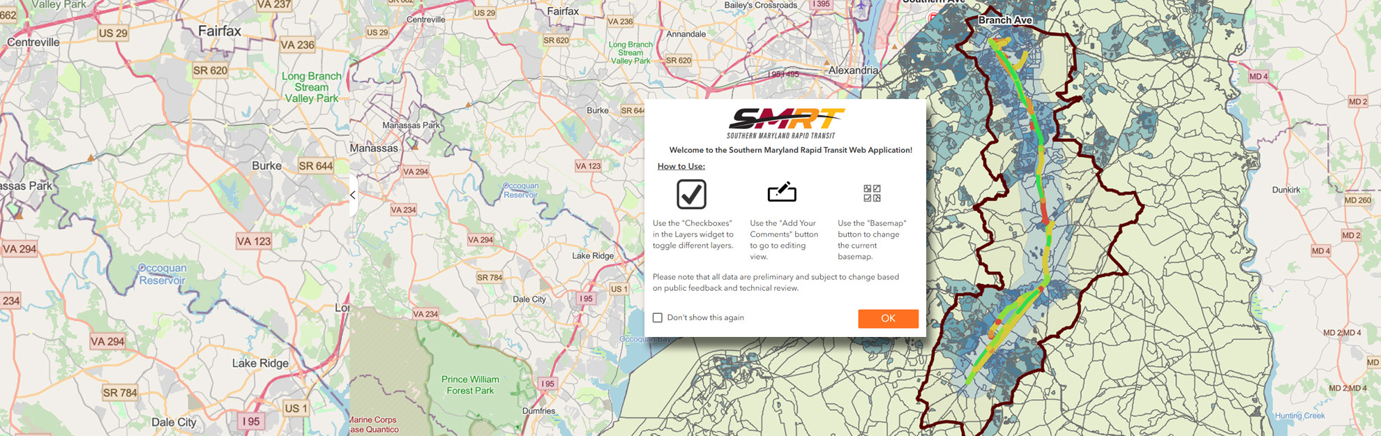
Interactive Map
Click on the interactive map below to see the SMRT PEL Study project corridor and various layers including existing corridor traffic operations, transit service and trends, environmental features, and socioeconomic data. The project study area/corridor along with potential alignments and previously proposed station locations are also shown. Click the Add Your Comments button to leave a comment at a specific location or segment and provide any thoughts about the locations and types of project-related improvements you’d like to see implemented. Quality feedback from stakeholders is a key component to developing a successful project that meets the needs of all users, and we encourage you to share your thoughts!